Poole History Online is a free online database of photographs, documents and data relating to the local history of the Borough of Poole. This website is managed by Poole Museum and updated by staff and volunteers. Find out more
about this site.
If you experience any problems, please see the
help page.
Showing results 11 to 18 of 18
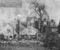
Museum Ref No: D_Barbers_Piles_0010Barbers Piles, rear of buildings. Label reads "A Study in Roofs. The rear of ancient buildings in Barbers Piles". A later note states "destroyed in German air raid Dec. 16, 1942". Chimneys.
Photograph
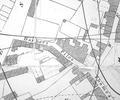
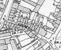
Extract from 1841 Plan
Map
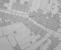
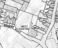
Extract from Ordnance Survey - 16.14
Map
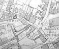
Extract from Ordnance Survey XL111.16
Map
Extract from Ordnance Survey XL111.16
Map
Extract from Borough Engineer's Plan 1952
Map
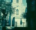
Museum Ref No: E4a_0002St James' church. South side, tower, seen from Barbers Piles. Railings and gate still in place.
Photograph
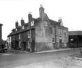
Museum Ref No: D_West_Quay_Road_0014West Quay Road/Barber's Piles
Photograph