Poole History Online is a free online database of photographs, documents and data relating to the local history of the Borough of Poole. This website is managed by Poole Museum and updated by staff and volunteers. Find out more
about this site.
If you experience any problems, please see the
help page.
Showing results 561 to 570 of 850
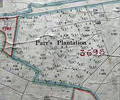
Museum Ref No: rVM_XLIV5_ParrsPlntionParrs Plantation, Pope's or Hope's Farm
Detail of Ordnance Survey Dorset Sheet XLIV.5 scale 1:2500 1900 revision with valuation annotations AC
Map
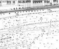
Extract from Ordnance Survey XL1V.10
Map
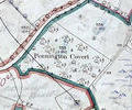
Museum Ref No: VM_XXXV13_PenningtonCovertPennington Covert, W side of Arrowsmith Rd below Brake Hills.
Detail of Ordnance Survey Dorset Sheet XXXV.13 scale 1:2500 1900 revision with valuation annotations AC
Map
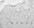
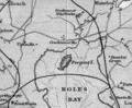
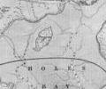
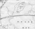
Museum Ref No: rVM_XLIII.12_PerginsIslandPergins Island, Holes Bay
Detail of Ordnance Survey Dorset Sheet XL.III.12 scale 1:2500 1900 revision with annotations. AC
Map
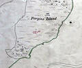
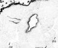
1785 survey, Mackenzie. Chart of Pergins Island
Map
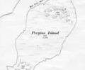
1849 chart, Sheringham. Pergins Island
Map
1902 Admiralty survey, Sheringham
Map
1910 chart, Simpson,Jones,Shaw,Kennedy,Rice
Map