Poole History Online is a free online database of photographs, documents and data relating to the local history of the Borough of Poole. This website is managed by Poole Museum and updated by staff and volunteers. Find out more
about this site.
If you experience any problems, please see the
help page.
Showing results 621 to 630 of 850
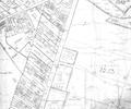
Extract from Ordnance Survey XL1V.9
Map
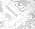
Extract from Ordnance Survey XL1V.5
Map
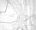
Extract from Ordnance Survey 9.21
Map
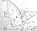
Extract from Ordnance Survey 13.1
Map
Extract from Ordnance Survey XL111.11 1901
Map
Extract from Ordnance Survey XL111.12 1902
Map
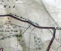
Museum Ref No: VM_Sheet XLIII_RockleaWd&HoltonPointRocklea Wood & Holton Point, Lychett Bay N of railway
Detail of Ordnance Survey Dorset Sheet XLIII:11 scale 1:2500 1900 revision, with valuation annotations. AC
Map