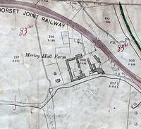
Merley Hall Farm
Merley Hall Farm, Dawson's Hole and Northern edge of Municipal boundary.
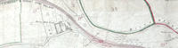
Detail of Ordnance Survey Dorset Sheet XXXIV.12, 1:2500 scale, 1900 revision with valuation annotations AC
Format: Map
Museum Ref No: rVM_XXXIV12_ MerleyHallFarm
Attachments:
Categories:
Last updated on
Contact us about this item
If you have further information about this item, or would like to suggest a correction please complete the update request form