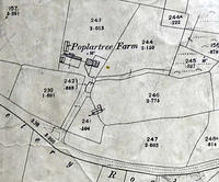
Poplar Tree Farm
Poplartree Farm, Oakdale, btwn Cemetery and Darby's Lane
Detail of Ordnance Survey Dorset sheet XLIV.9 scale 1:2500 1900 revision with valuation annotations AC
Format: Map
Museum Ref No: VM_XLIV9Poplartree
Attachments:
Categories:
Last updated on
Contact us about this item
If you have further information about this item, or would like to suggest a correction please complete the update request form