Showing results 351 to 360 of 6433
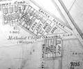
Extract from Ordnance Survey XL111.11 1901
Map
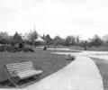
Museum Ref No: B6a_0114View of the bandstand in Poole Park with benches adjacent to the Saltwater lake, houses in the distance.
Photograph
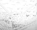
Extract from Ordnance Survey L1.5 1901
Map
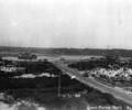
Museum Ref No: C_Sandbanks_0145Sandbanks: From dunes beside Banks Road towards Evening Hill, c.1920s.
Photograph
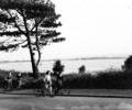
Museum Ref No: Batting/Box 3/Lilliput/No.1Cyclists on Banks Road, Lilliput. (Batting photograph)
Photograph
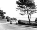
Museum Ref No: Batting/Box 3/Lilliput/No.2Motor cars and bicycle on Banks Road, Lilliput. (Batting photograph)
Photograph
Museum Ref No: BEAM_0005Establishment of Baptist Church in Poole.
Some names appended.
7 November 1735.
MS
JPBC
Document
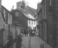
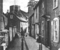
Museum Ref No: D_Barbers_Piles_0001Barbers Piles. Central drain and bollards.
Photograph
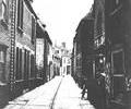
Museum Ref No: D_Barbers_Piles_0011Barbers Piles. Central drain.
Photograph
Museum Ref No: D_Barbers_Piles_0002Barbers Piles. Central drain and bollards.
Photograph