Showing results 91 to 100 of 1873
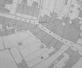
Extract from Ordnance Survey - 16.14
Map
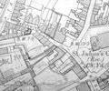
Extract from Ordnance Survey XL111.16
Map
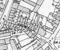
Extract from Ordnance Survey XL111.16
Map
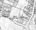
Extract from Borough Engineer's Plan 1952
Map
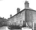
Museum Ref No: D_Thames_Street_0002sThames Street, King Charles Inn (formerly New Inn). Junction with Quay - Harbour Office (with bas relief of Benjamin Skutt, and Georgian doorway) and Town Cellars.
Photograph
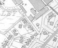
Extract from Ordnance Survey XL1V.10
Map
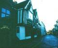
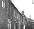
Museum Ref No: D_Bay_Hog_Lane_0001Bay Hog Lane, Nos.3-11. Dinghy in foreground. Photograph by Barbara Bristowe.
Photograph
Museum Ref No: D_Bay_Hog_Lane_0002Bay Hog Lane, side of No.3. Photograph by Barbara Bristowe
Photograph
Museum Ref No: D_Bay_Hog_Lane_0003Bay Hog Lane, Nos.9-12. Photograph by Barbara Bristowe
Photograph
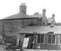
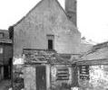
Museum Ref No: D_Bay_Hog_Lane_0004Bay Hog Lane, rear of No.10. Photograph by Barbara Bristowe
Photograph