folder
Showing results 181 to 190 of 215
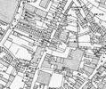
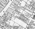
Extract from Ordnance Survey XL111.16
Map
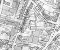
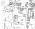
Extract from Borough Engineer's Plan 1952
Map
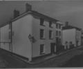
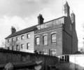
Museum Ref No: E1l_0011West Street at corner with Bay Hog Lane. Jolliffe House.
Photograph
Extract from Ordnance Survey XL111.16
Map
Museum Ref No: D_Westons_Lane_0002Weston's Lane. The Hermitage (former Congregational Manse), Weston's House and yard (Boone's?) with boats. Photograph Barbara Bristowe
Photograph
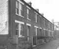
Museum Ref No: D_Westons_Lane_0003Weston's Lane, Nos.1-5. Photograph by Barbara
Photograph
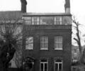
Museum Ref No: D_Westons_Lane_0001Weston's Lane. Weston's House. Barbara Bristowe
Photograph
Extract from 1841 Plan
Map
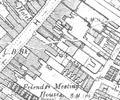
Extract from Borough Engineer's Plan 1952
Map
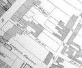
Extract from Ordnance Survey XL1V.10
Map