Poole History Online is a free online database of photographs, documents and data relating to the local history of the Borough of Poole. This website is managed by Poole Museum and updated by staff and volunteers. Find out more
about this site.
If you experience any problems, please see the
help page.
Showing results 611 to 620 of 850
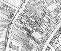
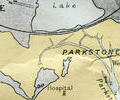
Extract from Borough Engineer's Plan 1952
Map
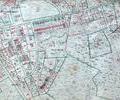
Extract from Ordnance Survey XL1V.9
Map
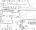
Extract from Ordnance Survey XL1V.10
Map
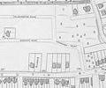
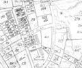
Extract from Ordnance Survey map 16.9
Map
Extract from Ordnance Survey XL111.16
Map
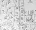
Museum Ref No: rVM_XLIII.4_WarMemorialRecGroundThe Recreation Ground, War Memorial, Perfume Manufactory and Water Tower in Broadstone. Detail of Ordnance Survey Sheet XLIII.4, 1:2500 scale, 1901 edition with valuation annotations.
Map
Extract from Ordnance Survey XL1V.10
Map
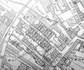
Extract from Ordnance Survey XL111.4
Map
Extract from Ordnance Survey XL111.16
Map