Poole History Online is a free online database of photographs, documents and data relating to the local history of the Borough of Poole. This website is managed by Poole Museum and updated by staff and volunteers. Find out more
about this site.
If you experience any problems, please see the
help page.
Showing results 791 to 800 of 850
Extract from Ordnance Survey 13.1
Map
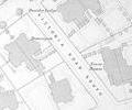
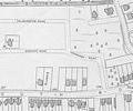
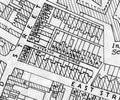
Extract from Ordnance Survey XLIV.13
Map
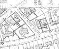
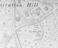
Extract from Ordnance Survey XL1V.10
Map
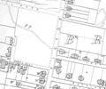
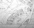
Extract from Ordnance Survey XL111.4
Map
Extract from Ordnance Survey XL1V.10
Map
Extract from 1841 Plan
Map
Extract from Ordnance Survey XL1V.9
Map
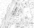
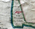
Museum Ref No: VM_XLIII.II_VineydCopseVineyard Copse, Symes Rd, Hamworthy.
Detail of Ordnance Survey Sheet XLlll:ll scale 1:2500 1900 revision with valuation annotations. AC
Map
Extract from Ordnance Survey XL1V.5
Map
Extract from Borough Engineer's Plan 1952
Map