Poole History Online is a free online database of photographs, documents and data relating to the local history of the Borough of Poole. This website is managed by Poole Museum and updated by staff and volunteers. Find out more
about this site.
If you experience any problems, please see the
help page.
Showing results 91 to 100 of 850
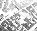
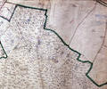
Extract from 1841 Plan
Map
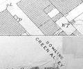
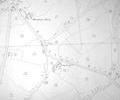
Extract from Ordnance Survey 16.9
Map
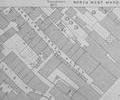
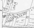
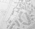
Extract from Ordnance Survey 16.14
Map
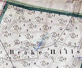
Museum Ref No: VM_XXXV.13_BrakeHillsBrake Hills,W of Arrowsmith Rd, S of Nurseries.
Detail of Ordnance Survey Dorset Sheet XXXV.13 scale 1:2500 1900 revision with valuation annotations AC
Map
Museum Ref No: rVM_XXX.13_MoortownCottsMoortown Cottages, Brake Hills, Stoats Hill, New Covert
Detail of Ordnance Survey Dorset Sheet XXXV.13 Scale 1:2500 1900 revision with valuation annotations AC
Map
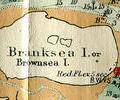
Extract from Ordnance Survey XL111.16
Map
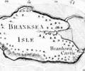
1785 survey, Mackenzie. Chart of Branksea Island
Map
Extract from Ordnance Survey XL1V.9
Map
Extract from Ordnance Survey XL1V.9
Map