Showing results 6531 to 6540 of 6572
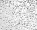
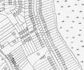
Extract from Ordnance Survey XL1V.10
Map
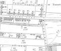
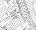
Extract from Ordnance Survey XL1V.10
Map
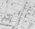
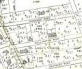
Extract from Ordnance Survey XL1V.10
Map
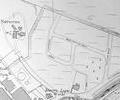
Extract from Ordnance Survey XL1V.10
Map
Extract from Ordnance Survey XL111.16
Map
Extract from Ordnance Survey XL111.16
Map
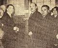
Museum Ref No: PPS120334p15Major C.R. Attlee, leader of the Opposition, opening Woodlands Hall, Labour's rallying place, taken from Poole & Parkstone Herald 12 March 1934
Photograph
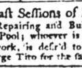
Extract from the Salisbury Journal for 28th June 1756. Proposals invited for repairs and building the "Keys of the Town and County of Pool". George Tito mentioned.
Newspaper
Museum Ref No: PLA 942.337History of the Town and County of Poole by John Sydenham, Poole, Sydenham, 1839 Pages 435-442
Book